
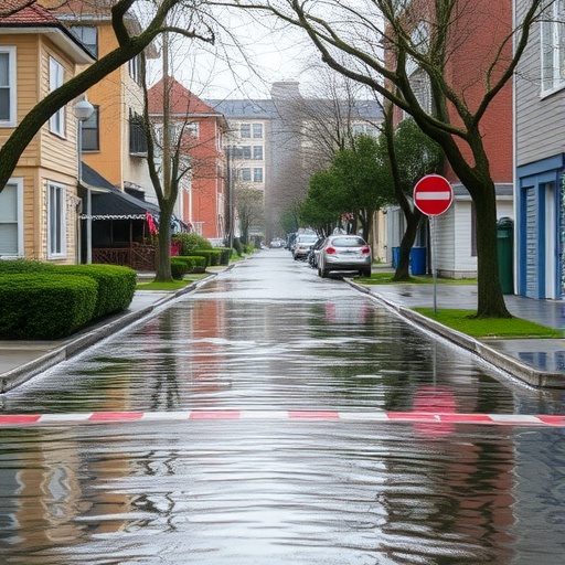
Urban flooding has emerged as one of the most pressing environmental challenges faced by modern cities worldwide. As urbanization accelerates and impermeable surfaces replace natural landscapes, the capacity of drainage systems and natural waterways to manage stormwater dramatically decreases. This phenomenon exacerbates flood risks, leading to significant economic damage, disruption of daily life, and threats to public safety. In this context, the innovative research conducted by Dehdehi, Soleimani-Motlagh, and Haghizadeh offers a critical evaluation and in-depth analysis of the factors influencing urban flooding using advanced hydrological modeling techniques. Their work employs the Soil Conservation Service – Technical Release 20 (SCS-TR20) model and the Sacramento Soil Moisture Accounting Unit Hydrograph (SBUH) model to unravel the complexities behind flood dynamics in urban environments.
The study begins by contextualizing the incidence of urban flooding within rapidly expanding metropolitan areas. Urban landscapes are characterized by an extensive network of roads, buildings, and other paved surfaces, significantly altering the natural water cycle by accelerating runoff and reducing infiltration. The authors argue that understanding these changes requires precise hydrological models capable of simulating surface runoff, infiltration, and subsurface flow processes under varying climatic and land use scenarios. Both SCS-TR20 and SBUH models boast comprehensive frameworks that may be tailored to urban catchments, enabling the dissection of hydrological responses to precipitation events with high spatial and temporal resolution.
Fundamental to their research is the exploration of how different physical and environmental factors affect urban flooding. These include soil properties, topography, storm characteristics, land use patterns, vegetation cover, and urban infrastructure design. The SCS-TR20 model, originally developed to estimate direct runoff from small watersheds, is applied here to quantify the runoff generation process by integrating rainfall data with land surface conditions. It incorporates parameters like curve number (CN), which reflects soil infiltration capacity and land cover, to predict peak discharge during storm events. This allows the researchers to examine how changes in impervious surface area or soil moisture status may intensify or mitigate runoff production in urban catchments.
Simultaneously, the study leverages the SBUH hydrological model, a unit hydrograph-based method that simulates watershed response to rainfall by accounting for soil moisture dynamics. The SBUH model provides a mechanistic representation of subsurface flow and its contribution to streamflow, which is often overlooked in simpler runoff generation models. By embedding soil moisture accounting within the urban context, the authors can capture delayed flow components and baseflow behavior, enriching the flood prediction process. This is particularly important in urban areas where drainage infrastructure can alter natural groundwater recharge pathways.
A critical component of their methodology involves calibrating and validating these models against observed hydrological data from urban watersheds experiencing recurrent flooding. The researchers emphasize rigorous parameter optimization to enhance predictive accuracy. They adopt techniques such as sensitivity analysis to identify which parameters most significantly influence model outputs, thereby guiding priorities for data collection and urban planning interventions. The models’ outputs are then cross-verified through statistical measures, including Nash-Sutcliffe efficiency and root mean square error, confirming their robustness in simulating runoff processes in real-world urban systems.
Their findings highlight that urban flooding is not solely dependent on rainfall intensity and volume but is profoundly affected by intricate interactions between soil characteristics, land cover changes, and urban drainage infrastructure. For instance, increasing impervious surfaces significantly raises the curve number, leading to more immediate and higher runoff peaks. Moreover, poor maintenance or design flaws in stormwater systems exacerbate flooding by reducing conveyance capacity. The study also reveals that antecedent soil moisture conditions before rainfall events play a pivotal role; saturated soils contribute to quicker runoff generation and potential flash floods, emphasizing the need for integrated urban water management that considers soil moisture dynamics.
The implications of this research extend to urban planners, environmental managers, and policymakers. By elucidating how specific landscape and infrastructure features influence flood risks, the models can inform the design of resilient urban drainage networks. Incorporating green infrastructure, such as permeable pavements, rain gardens, and bio-retention basins, can modulate runoff by enhancing infiltration and delaying peak flows, a strategy validated by simulation scenarios using their models. Additionally, the work supports the advancement of early warning systems that integrate hydrological forecasts with real-time rainfall data, offering communities proactive flood risk mitigation.
Significantly, the study advances the hydrological modeling field by adapting traditional models—initially designed for rural or agricultural catchments—to the complex hydrodynamics of urban settings. This adaptation includes customizing parameter sets to account for heterogeneity in urban land use, addressing issues such as localized flooding resulting from blocked drains or topographical depressions. The dual-model approach combining SCS-TR20 and SBUH affords a more comprehensive understanding than reliance on a single modeling framework, as it captures both surface and subsurface hydrological processes with greater fidelity.
Furthermore, the research contributes to global climate change discussions by considering how altered precipitation patterns may interact with urban factors to exacerbate flooding. The authors simulate future storm scenarios based on climate projections, revealing potential increases in flood frequency and severity if urban areas do not enhance their stormwater resilience. This evidence reinforces the urgency of integrating climate adaptation measures into urban development policies, underscoring the indispensable role of hydrological models in forecasting and managing emerging flood risks.
An additional innovative aspect of this study is the use of high-resolution spatial data and advanced computational techniques to implement the hydrological models. Remote sensing technologies and geographic information systems (GIS) are applied to delineate watershed boundaries, map land cover, and analyze slope and soil properties with great precision. The incorporation of these technologies allows for dynamic model updating and supports scenario testing for various urban growth and land use change possibilities. By utilizing such data-driven methods, the authors ensure that their flood impact analyses are both spatially relevant and temporally sensitive.
The multi-faceted modeling framework also evaluates the effectiveness of different flood mitigation strategies using scenario-based simulations. For example, the researchers model the impact of increasing urban green spaces or enhancing stormwater storage capacity on reducing flood peak discharge. These simulations provide actionable insights for urban engineers and policymakers by demonstrating which interventions yield the greatest reduction in flood risks under diverse weather conditions. Consequently, their work serves as a decision-support tool to prioritize resource allocation and infrastructure investments in flood-prone urban regions.
In summary, the comprehensive evaluation and analysis conducted by Dehdehi, Soleimani-Motlagh, and Haghizadeh signify a breakthrough in understanding urban flood dynamics through integrated hydrological modeling. By leveraging the strengths of SCS-TR20 and SBUH models, their study provides a nuanced depiction of how natural, built, and climatic factors coalesce to influence flooding in cities. These insights pave the way for smarter urban water management, resilience building against extreme weather events, and sustainable urban growth.
Looking forward, the authors advocate for further refinement of hydrological models through enhanced data assimilation and coupling with hydraulic simulations to address flooding at the street and neighborhood scales. They also suggest expanding their approach to encompass socio-economic dimensions, thereby assessing the human and economic impacts of flood events alongside hydrological predictions. Such interdisciplinary integration will be vital as urban flood challenges intensify in the face of urban expansion and climate variability.
Ultimately, this pioneering research not only enriches the theoretical hydrology landscape but also offers practical tools for urban flood mitigation worldwide. As cities grapple with the escalating frequency of intense storm events, such scientifically rigorous and technologically sophisticated studies provide a beacon for safeguarding populations, infrastructure, and ecosystems from the devastating consequences of urban flooding.
Subject of Research: Evaluation and analysis of factors affecting urban flooding through hydrological modeling.
Article Title: Evaluation and analysis of the impact of factors affecting urban flooding using SCS-TR20 and SBUH hydrological models.
Article References:
Dehdehi, N., Soleimani‑Motlagh, M. & Haghizadeh, A. Evaluation and analysis of the impact of factors affecting urban flooding using SCS-TR20 and SBUH hydrological models. Sci Rep (2026). https://doi.org/10.1038/s41598-026-58279-3
Image Credits: AI Generated
Tags: advanced flood prediction modelsclimate impact on urban flood dynamicseffects of urbanization on water cycleflood risk assessment in citieshydrological modeling for urban runoffimpact of impermeable surfaces on floodingSacramento Soil Moisture Accounting Unit HydrographSCS-TR20 hydrological modelsoil conservation service flood modelingsubsurface flow simulation in urban areasurban flooding factors analysisurban stormwater management