
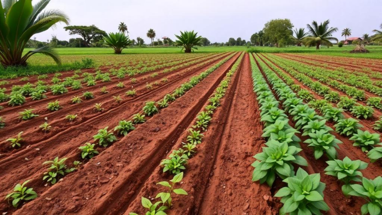
In the humid rainforest belt of Ondo State, Southwest Nigeria, the ground beneath a farmer’s feet tells a very different story depending on what grows above it. A new study of the Okitipupa and Irele local government areas has produced the first integrated statistical and map-based portrait of how five contrasting land uses—farmland, oil palm plantations, forest land, watersheds, and residential areas—reshape the physical and chemical fabric of tropical soils. The research, published in Discover Soil, combined systematic field sampling, laboratory analysis of twelve soil properties, principal component analysis, hierarchical clustering, and geographic information system (GIS) mapping to reveal patterns that conventional soil surveys have long missed.
The team, led by Olojugba Michael Rotimi of Olusegun Agagu University of Science and Technology, collected thirty composite soil samples per local government area using a systematic strip-sampling approach along transects ranging from 500 metres to 2 kilometres. At each replicate plot, five sub-samples were drawn from the top 30 centimetres with a stainless-steel auger following a W-shaped pattern across a 20 by 20 metre grid, then bulked into a single representative composite. Sampling plots were kept at least 50 metres from roads and settlements to avoid boundary effects, and duplicate samples from every fifth plot provided quality assurance. All samples reached the laboratory within 48 hours of collection.
In the laboratory, the researchers measured pH, total organic carbon, total organic matter, total nitrogen, available phosphorus, exchangeable sodium, potassium, calcium, magnesium, exchangeable acidity, cation exchange capacity, and base saturation, alongside the sand, silt, and clay fractions. Organic carbon was determined by the classic Walkley–Black wet oxidation, nitrogen by macro-Kjeldahl digestion, and phosphorus by the Bray-1 extraction suited to acid tropical soils. Exchangeable cations were leached with ammonium acetate and quantified by atomic absorption and flame photometry. Screening for total petroleum hydrocarbons returned zero at every sampling point, ruling out contamination as a confounding factor.
The headline finding is unambiguous: forest land consistently held the highest fertility of any land use in both local government areas. Forest soils recorded total organic carbon between 2.97 and 3.36 grams per kilogram, total organic matter between 5.14 and 5.79 grams per kilogram, total nitrogen between 0.15 and 0.27 grams per kilogram, and cation exchange capacity between 10.74 and 11.74 centimoles per kilogram. Farmland, by contrast, showed the lowest organic matter and the most acidic conditions, with Irele farmland falling to just 1.23 grams of organic carbon per kilogram—roughly 37 percent of the forest reference value and a level the authors describe as a critical threshold below which soil structure and nutrient retention can no longer sustain productive cropping without external inputs.
Oil palm plantations emerged as the most acidified land use, with pH values of 4.89 in Okitipupa and 4.92 in Irele. The researchers attribute this to ammonium-based fertiliser uptake and the production of organic acids as palm litter decomposes, a pattern well documented in oil palm systems from Papua New Guinea to Indonesia. Intriguingly, the Irele plantation bucked the organic matter trend, accumulating more carbon than its Okitipupa counterpart—possibly a legacy of older palms, greater litter return, or less intensive herbicide use. Residential soils, meanwhile, surprised the team by recording the highest available phosphorus of any land use in Okitipupa, a signature of household waste, garden composting, and horticultural fertilisers, and the highest organic carbon in that local government area thanks to erosion protection from buildings and impervious surfaces.
To make sense of the twelve interlocking chemical variables, the team turned to principal component analysis. Three components together explained 73.4 percent of the total variance. The dominant axis, accounting for 46.5 percent, loaded positively on magnesium, organic carbon, organic matter, cation exchange capacity, nitrogen, sodium, pH, and potassium—an ‘organic matter cascade’ in which decomposing litter releases base cations, raises pH, and generates new exchange sites on humic substances. A second axis (15.5 percent) contrasted calcium and exchangeable acidity against organic matter, while a third (11.4 percent) captured the independent geochemical behaviour of phosphorus and sodium, which are governed by oxide adsorption and runoff rather than organic dynamics.
Hierarchical cluster analysis using Ward’s minimum-variance method then sorted the land uses into ecologically meaningful groups. In Okitipupa, forest land and watershed soils formed a ‘naturally enriched’ cluster, separated cleanly from an ‘anthropogenically influenced’ cluster containing farmland, oil palm, and residential sites. In Irele, forest and oil palm clustered together as organically retaining systems while farmland and residential soils formed a depleted group. Crucially, the cluster structure held in both local government areas despite differences in parent material, providing strong evidence that land use—not geology—is the overriding determinant of soil variability in the corridor.
The GIS component translated these statistics into actionable maps. Using inverse distance weighting interpolation in ArcGIS, the team generated continuous raster surfaces for pH, organic carbon, nitrogen, phosphorus, potassium, calcium, magnesium, and cation exchange capacity, projected to the WGS 1984 UTM Zone 31N grid. The maps show high organic carbon and exchange capacity zones clustered tightly over forest land, contrasting with diffuse, lower-value patterns across farmland and residential areas. Watershed soils displayed their own distinct signature—high base saturation and unusually uniform properties—reflecting cation-rich inputs from upstream land uses and the stabilising influence of riparian vegetation. The Irele watershed stood out with a near-neutral pH of 6.23, markedly higher than its Okitipupa counterpart.
The findings arrive with global resonance. A landmark meta-analysis of more than 25,000 studies concluded that converting tropical forest to cropland typically strips 25 to 30 percent of soil organic carbon stocks, and a global database spanning 84 countries found that land-use change affects soil carbon seven to ten times more strongly than direct climate change. The 1.7-to-2.7-fold differences in organic carbon and exchange capacity between forest and farmland documented here fit squarely within that pattern, while adding granular, spatially explicit evidence from a region poorly represented in global soil carbon databases.
The authors distil three priority interventions. First, organic matter restoration on farmland—through crop residues, leguminous cover crops, and compost—is most urgent in Irele, where sandy substrates have accelerated depletion. Second, oil palm managers should adopt mulching with palm fronds, leguminous ground covers, and reduced herbicide frequency to counter acidification and carbon loss, practices shown elsewhere to stabilise or even raise soil pH. Third, remaining forest should be conserved as a fertility reference standard, since any further clearance risks irreversibly degrading the regional soil baseline. Future work, the team notes, should replace simple interpolation with geostatistical kriging, add bulk density measurements to enable carbon stock calculations, and integrate Sentinel-2 satellite imagery for wall-to-wall soil quality mapping across the landscape.
Subject of Research: Spatial variation of soil physicochemical properties across land use systems in Southwest Nigeria
Article Title: Spatial variation of soil physicochemical properties as influenced by land use systems in Southwest Nigeria
Article References: Spatial variation of soil physicochemical properties as influenced by land use systems in Southwest Nigeria. (n.d.). https://doi.org/10.1007/s44378-026-00321-x
Image Credits: AI Generated
DOI: 10.1007/s44378-026-00321-x
Keywords: soil physicochemical properties, land use, Southwest Nigeria, soil organic carbon, principal component analysis, GIS mapping, oil palm plantation, soil acidification, cation exchange capacity, forest conservation, precision soil management, tropical soils
Cite Scienmag News
APA MLA Chicago
Copy citation Download RIS
Tags: cation exchange capacityEffect of agriculture on soil nutrientsforest conservationForest versus farmland soil healthGIS mappingGIS mapping of land use and soil typesHierarchical clustering of soil propertiesland useLand use impact on soil propertiesoil palm plantationOil palm plantation soil analysisprecision soil managementPrincipal Component AnalysisPrincipal component analysis of soil datasoil acidificationSoil chemical and physical characteristics in NigeriaSoil degradation in residential areassoil organic carbonsoil physicochemical propertiesSoil sampling and laboratory analysis techniquesSouthwest NigeriaSustainable land management in Southwest NigeriaTropical soil quality comparison in Nigeriatropical soils