
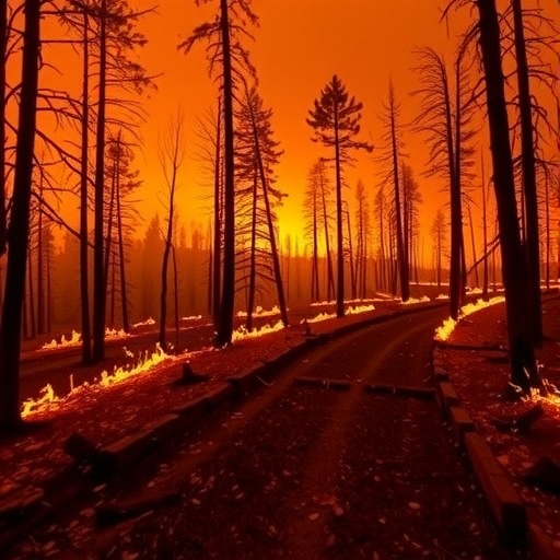
In the face of escalating wildfire threats across the United States, a groundbreaking study from the University of California, Santa Barbara, sheds new light on a critical factor determining community survival during these natural disasters: the number of accessible evacuation routes. This research, appearing in the prestigious journal Proceedings of the National Academy of Sciences, offers the most comprehensive georeferenced dataset on wildfire fatalities to date, analyzing 342 wildfire-related deaths spanning from 2008 to 2024. The study identifies a pivotal structural variable — road redundancy, specifically the number of outward road exits in a community — as perhaps the most decisive predictor of fatality risk during wildfires.
The research team embarked on mapping the intricate relationship between community egress pathways and wildfire mortality with unprecedented precision. They discovered a striking threshold effect in the data: as communities gain more outward-bound roads, wildfire fatalities drop precipitously, but only up to a specific point — around six exits. Beyond this threshold, adding more roadways yields diminishing returns in terms of improved evacuation efficiency or life-saving potential. This reveals an underlying infrastructural constraint rather than one influenced by community size, socioeconomic status, or demography.
Lead author Caitlin Fong articulates this key insight succinctly: “The threshold near six exits held remarkably consistent across geographies, and communities of different sizes. That tells us it’s a structural constraint, not a demographic one. Road redundancy is what saves lives.” The implication is profound — the sheer number of functional evacuation routes a community offers acts as a critical bottleneck during wildfire events, shaping the fate of its residents.
To contextualize this discovery, the study references some of the most harrowing wildfire tragedies in recent years. In the catastrophic 2018 Camp Fire, the town of Paradise, California — which had just six outward roads — suffered 66 fatalities out of the wildfire’s total 86 deaths. The infrastructure failed under the strain of converging fire fronts and evacuation gridlock. Similarly, the deadly 2023 Lahaina fire in Hawai’i resulted in 102 fatalities, with the community constrained by only four exit routes. Even smaller-scale disasters, such as the 2020 North Complex Fire in Berry Creek, California, which killed 13 people, illustrate the fatal consequences of limited egress options—with that town having only two exits available.
Beyond simply cataloging tragedies, the researchers expanded their scope to evaluate nationwide vulnerability. By integrating egress data from all U.S. communities with fewer than 50,000 residents alongside wildfire hazard maps and U.S. Census population data, the team produced a sobering overview of wildfire evacuation risk across the country. This approach not only quantifies risk but also pinpoints where intervention is most urgently needed.
The findings from this national assessment are especially alarming. Approximately 17.7 million Americans currently inhabit communities that fall below the six-exit threshold identified as critical for safe wildfire evacuation. Of these, roughly 2.5 million residents live in locales with both limited egress infrastructure and high wildfire hazard levels. Compounding the problem, 528 communities nationwide have no major road exit at all, spread across 41 states—underscoring a widespread and systemic deficiency in evacuation planning.
Moreover, the study debunks common assumptions that wildfire risk is confined chiefly to Western states. High-risk communities with precarious combinations of limited evacuation routes and significant wildfire threats exist in regions that receive comparatively little attention in national wildfire policy, including Oklahoma, Florida, and Hawai’i. As co-author Benjamin Halpern explains, “People think of wildfire as a Western problem. But we found communities with dangerous combinations of limited roads and high fire risk in places that don’t get a lot of attention.”
This research arrives amid an era of intensifying wildfires driven by escalating climate change impacts, underscoring the urgent need for proactive disaster preparedness. Co-author Max A. Moritz, a wildfire specialist with UC Cooperative Extension, stresses the gravity of the findings: “Seventeen million Americans are living in communities that, by this measure, are not designed to survive a fast-moving wildfire. That should be a wake-up call—not just for California, but for every state that thinks wildfire isn’t their problem yet.”
Despite the compelling association between road redundancy and wildfire mortality, the researchers caution against viewing road construction alone as a silver bullet. Terrain topography, ecological sensitivity, and prohibitive costs often constrain the feasibility of expanding evacuation infrastructure. Instead, they advocate for a multifaceted approach to wildfire resilience that combines where possible expanded egress capabilities with enhanced early warning systems, behavioral interventions to promote timely evacuations, and the design and investment in pre-planned shelter-in-place options such as temporary refuge areas, which can provide critical safety nets when evacuations fail.
Significantly, the team’s work offers practical tools for planners and policymakers. They have crafted detailed risk maps combining community egress and wildfire hazard data for smaller U.S. communities, publicly accessible via an interactive online platform. These maps empower emergency managers to identify vulnerable communities and prioritize limited resources strategically, bolstering tailored preparedness and mitigation efforts.
This study’s methodical, data-driven approach reflects a vital paradigm shift in wildfire science—from reactive crisis response toward resilience planning engineered on solid empirical foundations. By pinpointing infrastructural shortcomings with geographical precision, their findings create openings for targeted, effective interventions that could mean the difference between life and death when wildfires strike.
In sum, the research conducted by UC Santa Barbara’s National Center for Ecological Analysis and Synthesis and the Bren School of Environmental Science reframes wildfire safety as fundamentally a matter of engineering sound community egress frameworks—not just managing fire behavior itself. As wildfire seasons grow longer and more destructive with climate change, embracing such structural insights is indispensable for protecting millions of Americans living in vulnerable communities nationwide.
Subject of Research: Wildfire fatalities and evacuation infrastructure effectiveness
Article Title: Egress thresholds and wildfire fatalities
News Publication Date: 1-Jun-2026
Web References:
Interactive map of community egress and wildfire hazard across the United States
Wildfire Resilience Index
References:
Fong, C., Moritz, M. A., Halpern, B. S., et al. (2026). Egress thresholds and wildfire fatalities. Proceedings of the National Academy of Sciences. DOI: 10.1073/pnas.2535081123
Keywords: wildfire resilience, evacuation routes, road redundancy, wildfire fatalities, community egress, hazard mapping, disaster preparedness, climate change, emergency management, wildfire hazard, infrastructure planning, public safety
Tags: community evacuation infrastructuregeoreferenced wildfire mortality dataroad exits impact on wildfire fatalitiesroad redundancy and wildfire safetystructural variables in wildfire deathswildfire disaster preparednesswildfire evacuation efficiency thresholdwildfire evacuation routeswildfire fatality risk factorswildfire hazard mitigation planningwildfire safety research 2008-2024wildfire survival strategies